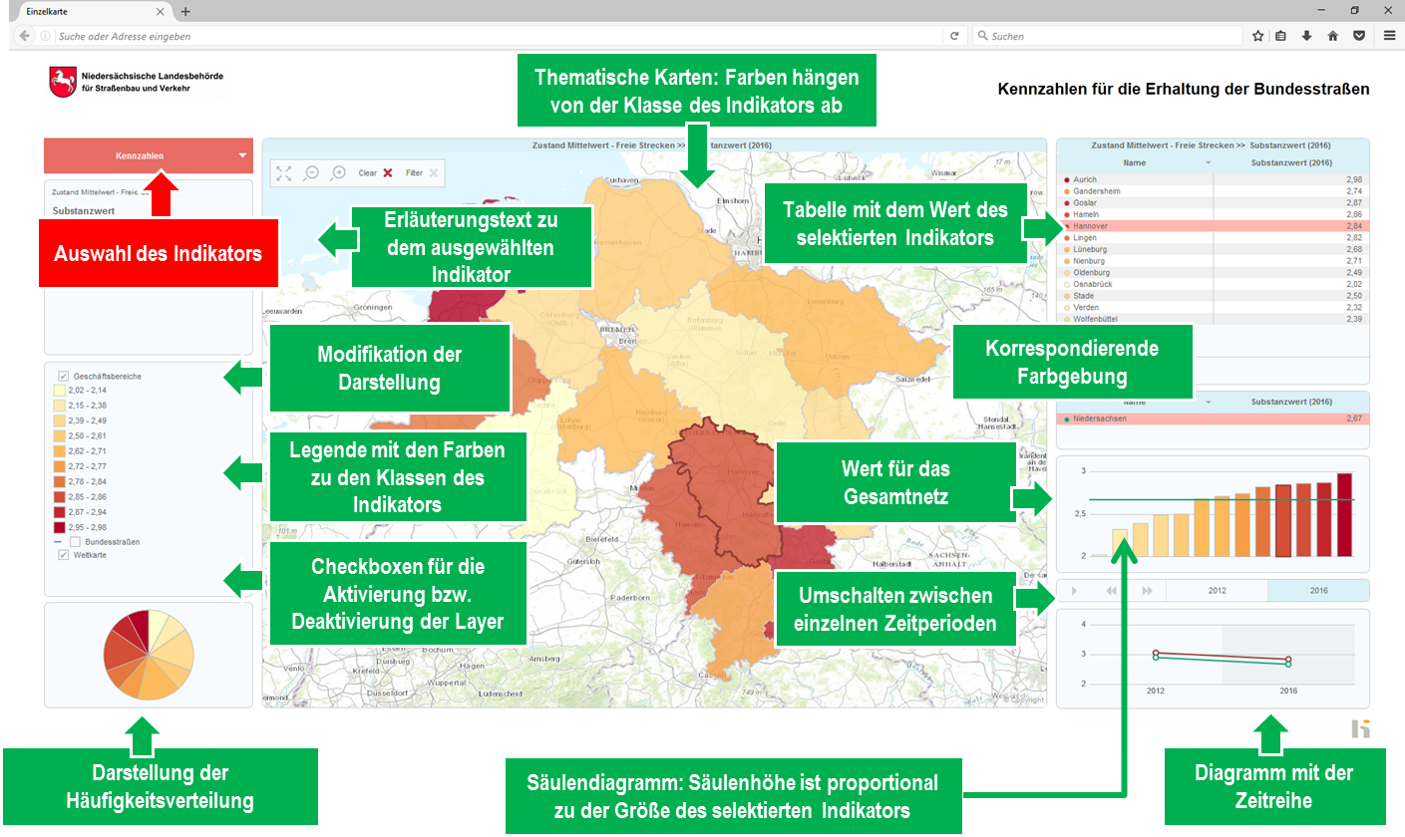
hiATLAS - Key figures for the strategic management

hiATLAS is a high-performance tool for the interactive display and use of area and object-related key figures. The modern web application is based on the globally renowned InstantATLAS platform from GeoWise (ESRI). The system was configured and extended by HELLER for the use in road administrations.
HELLER's methods allow complex infrastructure data to be efficiently evaluated, imported and mapped with hiATLAS in such a way that they can be used optimally for individual analyses, strategy development or controlling.