Pavement Condition survey of the cycle tracks and footpaths of the Hanseatic City of Lübeck
In the summer of 2018, the Hanseatic City of Lübeck carried out for the first time a measurement based pavement condition survey and assessment (ZEB) of the main and secondary city roads.
The project was carried out by the Darmstadt based HELLER Ingenieurgesellschaft mbH. The engineering company first developed a concept and then carried out the evaluation and assessment of the condition data. In addition to the presentation of the current condition, this included in particular the determination of the sections of road in need of maintenance and the overall maintenance requirements. The results were used for the budget planning and the design of the construction programme of the Hanseatic City. The procedure was designed so that the results can be efficiently updated in the future.
Based on the positive experience, the 2019 concept was extended to include the Hanseatic City's foot- and cycle paths. Currently, the inventory and condition of the cycle path network over a length of approx. 200 km has been surveyed. Parallel to this, the condition of the pavements with a length of approx. 1,200 km is being assesed. The results should be available in the second half of the year.
Assessment of the pavement condition of footpaths and cycle paths
The condition of the footpaths and cycle paths is usually recorded by the municipal building authorities as part of operational maintenance. Potential danger spots, such as potholes, are identified and repaired as part of the regular inspection. If selective repairs no longer appear sensible, larger sections of the road are included in the maintenance programme and then completely rehabilitated.
The aim of the currently implemented project is to map the backlogged maintenance needs of the entire network of foot- and cycle paths and to estimate the future funding requirements. For this purpose, measurement based methods will be used for the first time in the Hanseatic City of Lübeck.
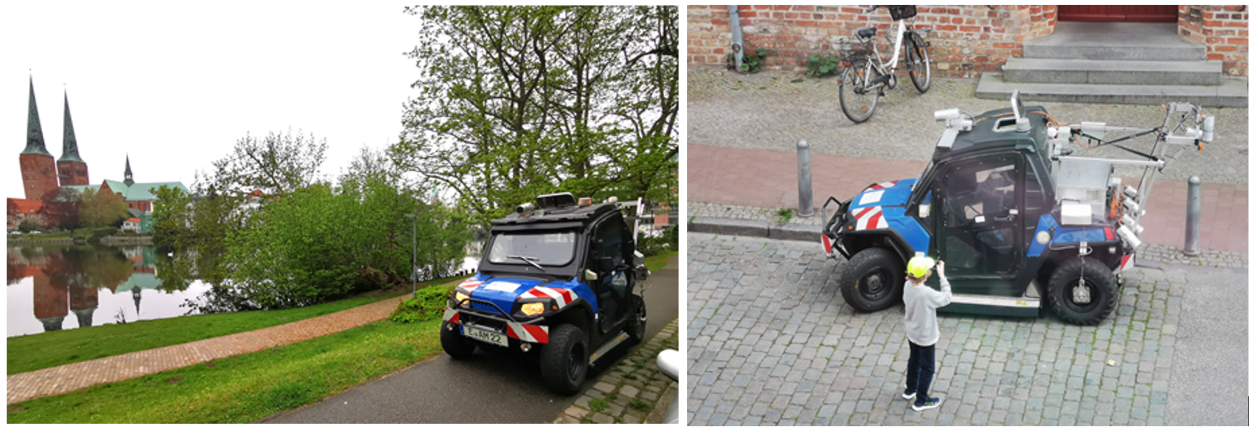
The surface distress of the cycle paths was photographed with cameras and the evenness will be recorded and evaluated by laser. Currently, highly specialised measuring technology from TÜV Rheinland Schniering GmbH has been used for this purpose. The company has been active in the field of road condition monitoring since the early 1990s and has already implemented numerous comparable projects in the field of cycle path infrastructure.
A major advantage of the measurement based approach is that the condition can be surveyed very efficiently and quickly. Furthermore, the procedure is very transparent and essentially free of subjective influences. The recording can be repeated in the future. In this way the development of the network can be described and the success of the maintenance planning can be evaluated.
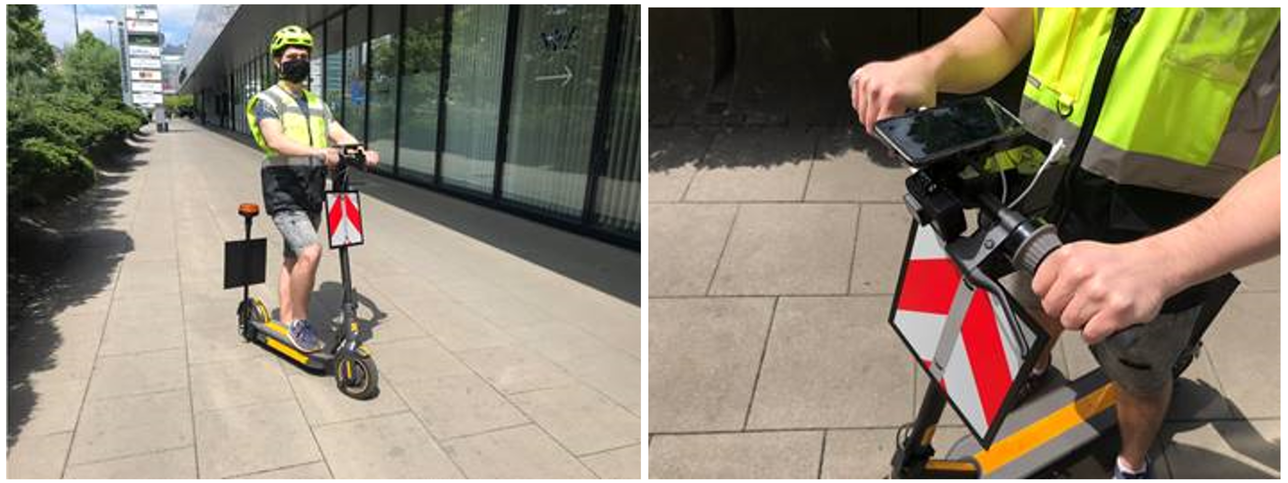
While the survey of cycle paths has been finding more and more new users nationwide since 2006, there have been no comparable standards and procedures on the market. Due to the partly very narrow sidewalks, ATVs (All Terrain Vehicle) could not be applied here.
Together with experts from HELLER Ingenieurgesellschaft mbH, the Hanseatic City of Lübeck therefore decided to break new ground and design a new measuring method. In this innovative approach, an e-scooter from Heller Consult Sp. z o.o. is used to drive on the sidewalks and the condition is recorded by a camera and special sensor technology. The evenness is assesed from the user's point of view. Based on the recorded data, the forces acting on the vehicle caused by unevenness can be displayed. In addition, the geometry of the surface can be determined in the form of a longitudinal height profile. The wheels used for the measurements are comparable to the front wheels of a wheelchair or the wheels of a rollator. Therefore, the needs of elderly or handicapped people in particular can be taken into account. The location of the data is based on geo-coordinates. The high-resolution route images recorded during the measurement can be used to evaluate the required substance preservation and other relevant information. License plates and faces are automatically made anonymous.
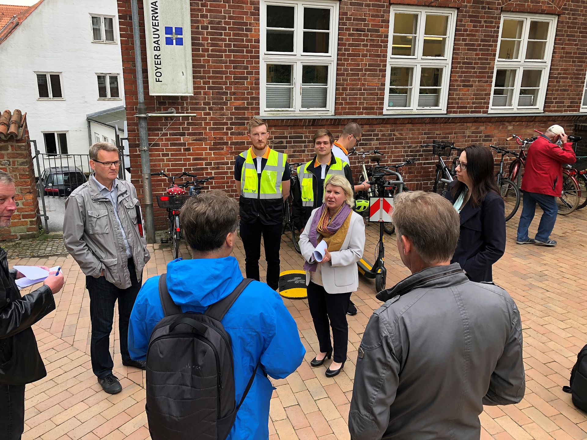
On June 4, 2020, a press event was held with local media and the Lübeck road construction administration. "In addition to the expansion of the cycle paths, we must also pay close attention to the existing network. Cycling should be safe and fun. This is only possible if we continuously invest in driving safety and comfort", says construction senator Joanna Hagen. "For this we need the necessary funds and a strategic approach. But we also want to take care of our pavements. The sidewalks are getting on in years and urgently need a fresh cell cure".
Photo above: Head of Road Maintenance Oliver Neß (left) and Construction Senator Joanna Hagen (centre)
Further information:
More pictures: