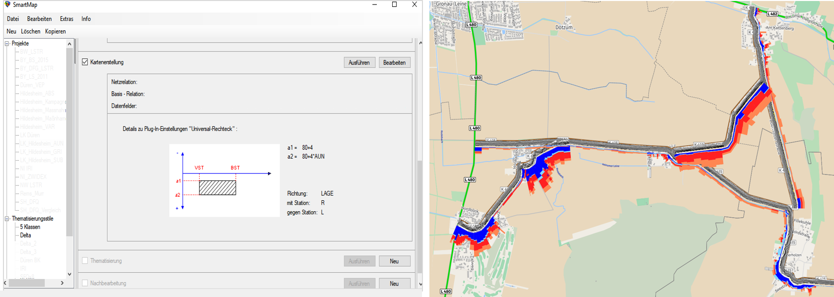
SmartMap - System for creating professional maps

SmartMap is a powerful tool for creating professional, technical maps. The basis is any ASB-compliant information on roads. These can be linked with the road network and graphically visualized as lines, areas, symbols or text objects and individually designed in color. The system supports the user with an interactive and straightforward menu navigation and offers a large selection of display options. All settings can be saved individually and passed on to other users as scripts. The possibility of programming macros allows the creation of thematic maps to be fully automated. Using batch operation, multiple productions can be generated from previously prepared templates.
HELLER uses SmartMap as a standard in service projects. It is also used in various road administrations for the visualization of inventory, condition, accident and many other road-related data. The MapInfo format is used by default for the output. This enables further processing in the usual GIS applications.
Advantages at a glance
- Convincing visualizations for planning and decision-making
- Simple handling
- Preparation and use of templates
- Batch operation for series production
- Use of common data sources (network reference according to the road database ASB)
We will be pleased to advise you in detail and present the system to you with practical examples.